
The MF CAMERA Product Integrates a Wide Range of Third-Party WiFi Day/Night and Thermal Cameras to the MinFarm Optimized Protocol Over Satellite Architecture. This Provides Reliable Connectivity Over Satellite For Visualization and Monitoring of Remote Assets In No Power, No Cellular and Hazardous Outdoor Environments (Download MF CAMERA Data Sheet)
CCTV over low power satellite use cases
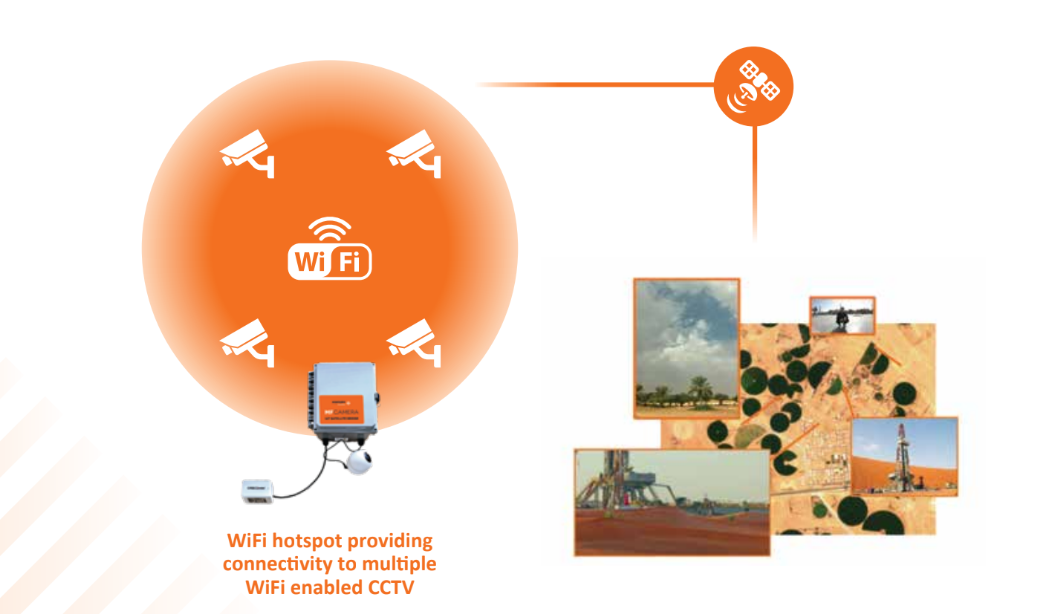
CCTV is an integral part of a remote asset management system, augmenting SCADA systems by providing visual explanations for sensor uplink data alerts. MinFarm’s new CCTV image capture product MF CAMERA (read more) works seamlessly with customer private network infrastructure to provide image capture capabilities over low power satellite terminals to environments that previously were beyond the scope of this technology due to the remoteness of their location. Use cases for this new technology include:
- Offshore unmanned rig monitoring
- Oil and gas pipeline monitoring
- Remote speed camera data collection
- Remote border monitoring
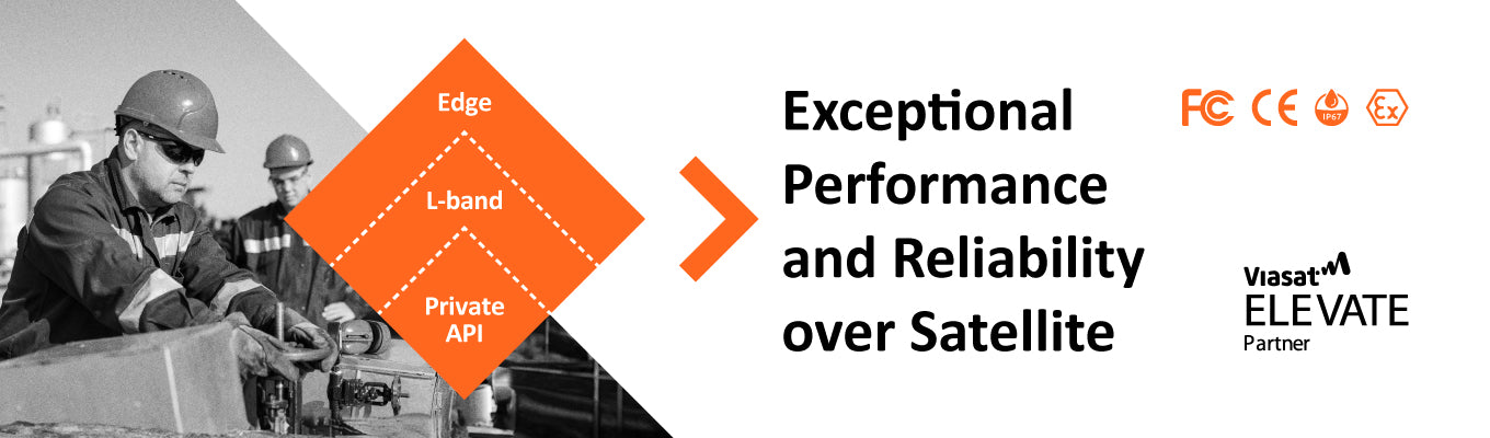
CCTV and Edge AI works well with the MinFarm Architecture
The MinFarm architecture uses low data or ‘narrowband’ satellite terminals with powerful edge technology and private server API calls, to ensure reliable and useful data transmission from remote field devices. Edge AI in image capture processing works well in this architecture, as it can be controlled by API downlink calls, and these calls with their responses can use very little satellite data. The benefits of Edge AI image processing in this architecture are:
- Reduced latency in decision making processing based on visual input (Edge processing)
- Significantly reduced use of satellite bandwidth for the transmission of Edge AI image processing results versus full image or video sequences for HQ analysis
MF Camera and Edge AI example stacks
Examples of Edge AI image processing stacks that can be used on the MF CAMERA product platform and with the MinFarm architecture are:
- Automatic number-plate recognition (ANPR)
- Crowd counting
- Object identification
Edge AI and Secure Edge Storage
The storage of high resolution images and videos with identification tags (object identification names, license plate numbers etc.) on the edge is another feature of the MF CAMERA product that works well with the MinFarm optimized satellite protocol architecture. The MF CAMERA allows several million, high resolution images (1MB plus) to be stored for later retrieval over satellite (or locally) by an API with relevant identification tag information. For example: REST API searches from a corporate network of the edge database could pull images related to certain objects or license plates. This type of on demand retrieval of required data files suits a low bandwidth satellite architecture.
How CCTV and Sensor Deployments Can Work Together on a Private Network Using Satellite with the MinFarm API
CCTV image capture can work in sensor field deployments for asset management when integrated into a centralized API like the one used in the MinFarm optimized satellite protocol architecture (read more). Here is an example data flow of such a hybrid sensor and CCTV camera deployment working together on a private network.
- Car approaches gate at remote location with no cellular or grid power
- LoRaWAN® proximity sensor is triggered
- LoRaWAN® proximity sensor uplink is received by the listening MF GATEWAY outdoor solar unit over a distance of up to 5km (read more about the MF GATEWAY product)
- Uplink is transmitted via the MinFarm optimized satellite protocol architecture over MF GATEWAY L-band satellite link
- Satellite data is sent over a geostationary satellite to a managed service teleport REST API (read more about MinFarm Satellite connectivity over L-band)
- The MinFarm REST API server, running on a privately hosted network server, calls the Teleport REST API to retrieve bundled payload uplinks and send waiting command downlinks. This call is made from behind a customer’s private network Firewall (read more about the MinFarm REST API and security architecture)
- The MinFarm REST API unpacks the proximity field device LoRaWAN® payloads and forwards the raw data to a customer application
- The customer application calls the MinFarm API and requests it to send a downlink image retrieval command to the MF CAMERA unit located near the remote gate location. The image retrieval command specifies the WIFi camera to be used and the image compression level.
- Downlink message traverses the L-band satellite network via a managed service Teleport REST API
- Designated camera takes an image of the car and driver
- MF CAMERA edge license plate recognition AI software stack turns license plate into text and sends an uplink message to the REST API where operator can request image of driver
- Gate opens if all approvals for license plate and driver are passed according to customer parameters